Plans, Policies & Processes
The Acadiana Metropolitan Organization works with regional partners and stakeholders to create long-term transportation and safety plans for our region. This collaborative work is essential for knowing how to direct funds and for making the maximum impact on our communities.
Transportation Documents
2040 Bikeway Plan and Map Inventory

2040 Bikeway Plan
The 2040 Bikeway Plan is designed to serve as a guide for the development and improvement of a safe, interconnected and efficient bikeway transportation system for the Acadiana MPO area. The plan includes an inventory of existing bikeway facilities and existing guidelines related to bikeway facilities. It also outlines an implementation plan with design guidelines, identifies possible funding sources and outlines possible bicycle safety education programs.
To read more about the 2040 Bikeway Plan and review the Bikeway Plan Maps, please click on the links below.
2040 Bikeway Plan and Maps:
- 2040 Bikeway Plan
- Map 1, Existing Facilities
- Map 2, City of Lafayette Existing Facilities
- Map 3, Proposed 2040 Bike Facilities, rev2020
- Map 4, 2040 Bike Facilities in the City of Lafayette, rev2020
- Map B-1, Destinations
- Map B-2, Lafayette
- Map B-3, ULL
- Map B-4, New Iberia
- Map B-5, Brossard
- Map B-6, Youngsville
- Map B-7, Scott
- Map B-8, Duson
- Map B-9, Carencro
- Map B-10, Sunset Grand, Coteau
- Map B-11, Breaux Bridge
- Map B-12, Parks
- Map B-13, St. Martinville
- Map B-14, Loreauville
2040 Freight Plan
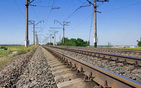
The 2040 Freight Plan serves as a reminder of the importance of Freight movements throughout the Acadiana MPO area. The document highlights ways of dealing with and improving freight movements, most of which are Truck pass through trips.
Read more about the 2040 Freight Plan.
2040 Pedestrian Plan

The 2040 Pedestrian Plan was developed by the MPO to provide guidance for the pedestrian network in the Acadiana MPO area. The plan includes an inventory of existing sidewalks for municipalities in the Acadiana MPO, evaluation of existing sidewalk policies, and evaluation of regulations related to pedestrian facilities. In addition, the 2040 Pedestrian Plan identifies possible funding sources for pedestrian facility construction. The MPO has developed a Story Map with in-depth map and plan information for increased public engagement.
To read more on the 2040 Pedestrian Plan and review the 2035 Pedestrian Plan Map, please click on the links below.
2040 Roundabout Plan
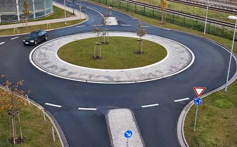
Roundabouts are proven as a safer traffic control device than all other types of traffic control (4 way stops, signals, yield signs, etc…). The roundabout policy states that any entity within the Acadiana MPO area must first consider a roundabout as the first type of traffic control device before other options.
Read more about the Roundabout Plan or review the map.
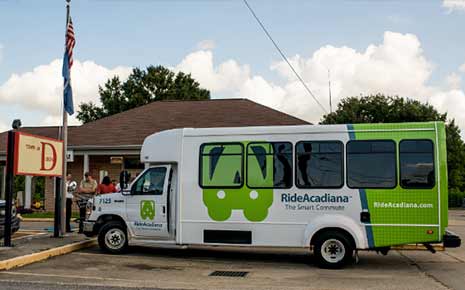
2035 Transit Plan

Read more about the 2035 Transit Plan.
Acadiana’s Coordinated Human Services Transportation Plan
Acadiana MPO Public Participation Plan

Complete Streets Policy

Complete streets are streets for everyone. They are designed and operated to enable safe access for all users, including pedestrians, cyclists, transit users, and motorists. People of all ages and abilities are able to safely move along and across complete streets, regardless of how they are traveling. Complete streets make it easy to walk or bicycle to bus stops, school, work, and shops. There is no singular design prescription for complete streets; each street is unique and responds to its community context.
By adopting a complete streets policy, the Acadiana MPO ensures transportation planners and engineers, working on projects that fall under the MPO’s purview, routinely design and operate the entire right of way to enable safe access for all users, regardless of age, ability, or mode of transportation.
Read more on the Complete Streets Policy.
Congestion Management Process

The Congestion Management Process (CMP), which has evolved from what was previously known as the Congestion Management System (CMS), is a systematic approach, collaboratively developed and implemented throughout a metropolitan region, that provides for the safe and effective management and operation of new and existing transportation facilities through the use of demand reduction and operational management strategies. The CMP is required to be developed and implemented as an integral part of the metropolitan planning process in Transportation Management Areas (TMAs) – urbanized areas with a population over 200,000, or any area where designation as a TMA has been requested. Although the CMP is not required in non-TMAs, the CMP represents the state-of-the-practice in addressing congestion, and should be considered in metropolitan areas that are facing current and future congestion challenges.The Congestion Management System has been described as a “7 Step” process; with the addition of a new “first step,” the Congestion Management Process is an “8 Step” process, as follows:
- Develop Congestion Management Objectives;
- Identify Area of Application;
- Define System or Network of Interest;
- Develop Performance Measures;
- Institute System Performance Monitoring Plan;
- Identify and Evaluate Strategies;
- Implement Selected Strategies and Manage Transportation System; and
- Monitor Strategy Effectiveness.
Read more about the Congestion Management Process.
Title VI Plan

Title VI prohibits discrimination on the basis of race, color, or national origin in programs and activities receiving federal financial assistance. Specifically, Title VI provides that no person in the United States shall, on the grounds of race, color, or national origin, be excluded from participation, be denied the benefits of, or be subjected to discrimination under any program or activity receiving federal financial assistance.
Read the 2019 Title VI Plan.
To read the 2024 Title VI Plan click here (Public Comment)